Priory Food Bank Winter Collection: Drop-Off Points and Most Needed Items
October 12, 2026 - Announcements


October 11, 2026 - Announcements
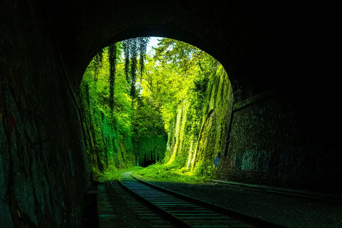
There is a stretch of the Priory where the houses thin out, the pavement gives way to a muddy ribbon of path, and the only sound is wind moving through hawthorn. Most people who walk it have no idea they are following a railway. The old Priory line closed to passengers decades ago, but its route survives almost intact — in embankments, brickwork, the occasional stub of rail, and the long green seams that run north out of town through the fields.
What follows is a beginner's guide to that line: roughly where it went, what you can still see, and how to explore it without annoying the people who live alongside it.
Think of the old line as a loose S rather than a straight run. It began at the goods yard beside the canal wharf, where a low brick shed still stands with its doors missing, then curved east behind the terraces before swinging north across what is now the bypass. From there it followed the shallow valley towards the village, running on embankments where the ground was soft and in cuttings where it wasn't.
The walkable stretch is roughly the middle section — call it three miles end to end, though you can easily break it into shorter pieces. Old Ordnance Survey sheets are the best way to trace the rest, and the local heritage society keeps copies you can look at. Compare a map from before the closure with one from today and the alignment jumps out: field boundaries bend around it, newer housing turns its back on it, and footpaths still use it because it is flat and dry underfoot.
The permanent way — the rails, sleepers and ballast — has mostly gone, lifted and sold long ago. What remains is the shape of the thing. Look for:
What has gone is just as telling. The station buildings were demolished, the level crossing gates replaced with nothing at all, and the sidings built over. Once you know that, a modern street map starts to look like a puzzle with half the pieces missing.
Railway engineers took the shortest sensible route, which means they cut through hills and raised the ground across hollows. Walk a stretch and you can feel the logic of it: the path levels out, the sides rise, and the hedges sit higher than your head on both sides. That's a cutting. Where the ground falls away on either side and the path runs along a ridge, you're on an embankment.
Keep an eye out for the details. A line of white ceramic insulators on a fence post usually marks where a telegraph wire ran. Square gateposts in the middle of a hedge often mark a field boundary the railway bought through. Patches of gravel in an otherwise silty path mean you're standing on old ballast.
Houses built after the closure tend to face away from the line or sit at an odd angle to it. Houses from before it tend to face towards it, because that was the road. That single clue can help you date a street without opening a single book.
This is a disused line, not a maintained trail. A few habits make the difference between a good afternoon and a twisted ankle:
Not all of the old line is open to the public, and the bits that are don't always look like it. If a gate is closed, close it behind you. If a path seems to run through someone's garden, it probably does — take the marked route instead. Where access is genuinely unclear, the council's rights of way team is the right place to ask; the definitive map is the legal record, and arguing the point with a landowner in a field helps nobody.
Park considerately. The lanes near the old halt are narrow and farm vehicles need the passing places. A car left half on the verge can block a working entrance for hours.
The line has become a corridor, and that's the best reason to walk it slowly. The cutting stays damp and shaded, so ferns and mosses do well there; the embankments are drier and flower earlier. Spring brings the birdsong and the mud. High summer means nettles up to your waist and a path that disappears in places. Autumn is arguably the best time — the undergrowth dies back, the alignment becomes obvious again, and you can see through the hedges to the field patterns.
Winter walking is fine, but go early. The cutting holds frost all day and the light drops fast behind the embankments.
Take a paper map, or a downloaded one, because the route looks obvious on the ground until it doesn't. Bring water, a waterproof layer and something to eat — there are no shops once you leave the wharf end. Wear trousers rather than shorts if you're pushing through growth. And if you're new to the line, walk it in one direction first with someone who knows it, then come back and explore the sidings, the spur and the wharf-side buildings at your own pace. The Priory's railway is a quiet piece of local history, and it rewards the slowest walkers most.
Photo: Paco Alonso / Pexels

A practical guide to the Priory Food Bank winter collection, including every drop-off point, the items volunteers...
A practical guide to Priory primary school admissions — the dates that matter, how catchment and sibling rules...
October 11, 2026 - Announcements
Copyright © 2026 The Priory Beacon. All Right Reserved.